This was our 3rd trip to Moab. Our
first trip was in 2014 where we camped for the weekend with our son Forrest and
his family, our second trip was in 2015 where we spent a few days visiting our
friends Dino and Lisa. This time….we were alone.
After leaving Lake Powell we spent the night at Sand Island BLM Campground in Utah. This was a nice little park with several big rig sites right along the river.
We arrived at OK RV
Park in Moab the next day. This is the campground where Dino and Lisa
worked for two seasons and once we mentioned we were friends of theirs we were
given the royal treatment! Given the best spot in the park, a welcome basket
that included caviar, Champaign and chocolate covered strawberries, free passes
to the spa and turndown service every night. Well, maybe not but the owners and
their former co-workers do miss them.
At $20/night with Passport America this is a
great little park to stay at for a few nights.
We were staying 2½ days/3 nights so we thought
we would get a couple of hikes/jeep adventures in but between the chores and
rain we only ended up getting one adventure in. But what an adventure it was!
Friends John and Pam have been here multiple times so we searched their blog
for the ultimate hike. After reading several of their posts and texting back
and forth we chose two hikes in Arches National Park; Tower Arch and the Fiery
Furnace ranger led hike if we had time.
We had never been to Arches so we were looking
forward to the visit. There are over 2,000 arches in Arches National Park. I am
happy to report that only have about 1,995 left to see! Needless to say we have
many visits ahead of us if we plan on seeing any more.
At the Visitors Center we discovered that the
Fiery Furnace hikes were not starting for a couple of weeks so we just got our
Passport Book stamped and off we went! The Tower Arch trailhead is in the
northwest corner of the park meaning we had to drive almost the whole length to
get to the trailhead. Perfect opportunity to see the varying landscape within
the park!
We had originally planned on taking the 3.5 mile
roundtrip hike to the arch but while reading the trail description on the way
to the trailhead we discovered that there is a jeep trail that leads to another
trailhead only .3 miles from the arch. The description said that it was a rough
jeep trail requiring 4 wheel drive, high clearance and was often impassible
after rain storms. Looks like the perfect opportunity to do a combo adventure!
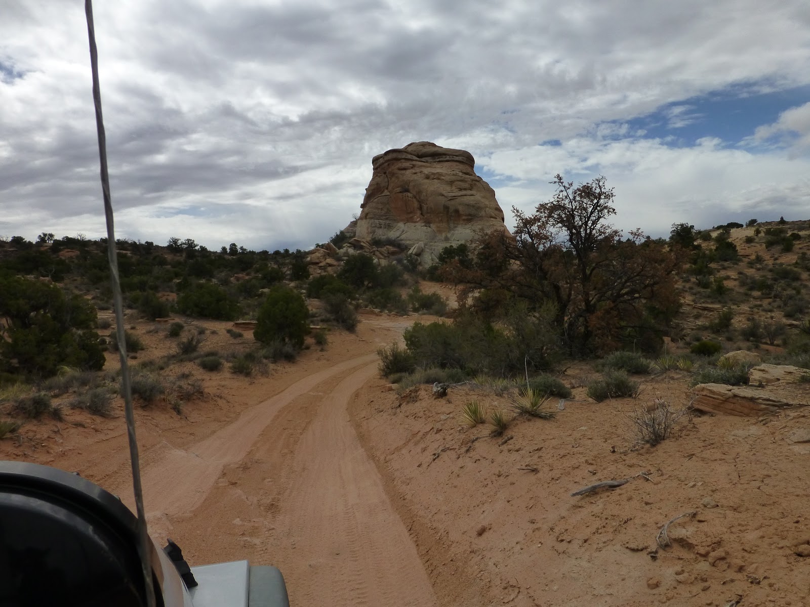
When we left the main road onto the jeep trail
it was smooth sailing for the first mile or so. We thought this was going to be
a piece of cake and we would be at the .3 mile trailhead in no time. We soon
learned at we were wrong……very very wrong. What started out as a 25mph gravel
road quickly turned into a 1-5mph rock crawl.
The road started out pretty smooth
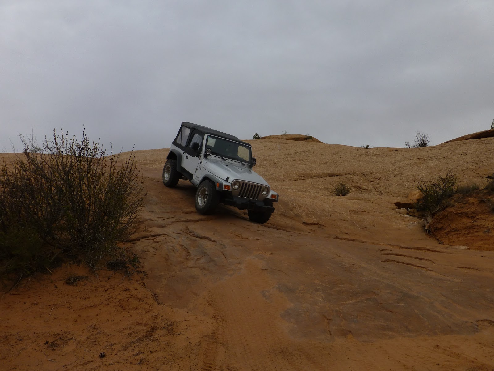
Then it got rough.... these pictures just don't do it justice
Headed up!
View from the top.....with the road leading off
On a difficulty scale of 1-10 I would give 5 or 6.
There were no real pucker moments but it was rough and you had to go very slow
and pick your spots or you would find yourself hung up. There were several
times Barb got out to take pictures and was walking faster than I was crawling
over the rocks. We spent the next hour and a half in 4 low crawling up and
around obstacles as we made our way to the trailhead. It was a blast!
There were views in every direction!
Tower Arch is just to the right of the Jeep
Once we got to the trailhead we could see Tower
Arch right in front of us. The challenge was getting to it. There is a sign
that tells you to stay on the marked trail which we had no problem doing for a
while until it lead to a slick rock section where the trail totally
disappeared. After a little trial and error we found the right trail and soon
we were at the arch!
Which way to the arch?
Barb and I split up and did some solo exploring.
I went up behind Tower Arch.....
You can see Barb in the lower right corner (blue dot)
....while she went to the right where there is another
smaller arch that is worth exploring.
If you look really close you can see me on a ledge in the middle under the arch
The second arch in the area
When we met up an hour or so later back at the
jeep we found that our .3 mile hike had turned into a over 2 miles of hiking
and exploring. We wanted a different
jeep trail on the way out. This trail led south 9 miles and west another 7
before it intersected highway 191 outside the park. There are several areas of
soft sand so only north/south travel is recommended on this road. After going
through it and seeing the tracks left by those trying to go north, I don’t know
how you could ever do it.
Along the way we passed Eye of the Whale arch,
another one we can cross off our list!
After exiting the park (after about mile 4 of
our westerly leg) we found ourselves in the Willow Springs boondocking area. We
had wanted to check it out to see if this is somewhere we would want to stay on
future trips. It was packed! Kids, 4 wheelers, dirt bikes…doesn’t anyone work
or go to school anymore? It must have been spring break at school or something.
There were a few spots that our rig would fit but if it is always this crowded
we will pass.
The yellow line shows our route for the day. We entered on the south end and exited to the west
We got back to OK RV Park at about 4pm meaning
our entire trip took about 6 hours. This is about our limit for leaving the
dogs alone so it worked out well.
The next day it rained almost all day so we
read, did some laundry and walked the town just to get out and about. Being
cooped up in the rig that third day cut into our adventure time and made this
trip to this area seem short. Time to move on and make our way north!
Our main reason for coming to the Page area was
to visit the infamous Antelope Canyon. After reviewing the reviews and
information from both Upper and Lower Antelope Canyons we chose to tour the
lower through Dixie Ellis' Tours. From everything we read the tours are in
vastly different types of slot canyons and we were prepared to be wowed!
What we weren’t prepared for was being wowed
even before got to the canyon. We were told by several RV friends that the Lone
Rock camping area was one of their favorites and within minutes of arriving it
quickly made it to our top 10 as well!
We were told there was camping right on the
beach or a little higher up where the views are just as spectacular. We were
warned that if we did dare to take the rig down to the beach area make sure we
stayed on the hard packed area or you will find yourself shelling out hundreds
of dollars in towing fees. After arriving and seeing how cool the beach camping
looked there was no question where we were headed!
We parked the rig up top and scouted the area
with the jeep picking our spot and the best route to get there. Our friends
were right, stray a few feet off the hard pack and you would be axle deep
before you knew it.
We arrived on a Tuesday and enjoyed the afternoon
on the beach. The dogs ran and swam for hours loving the freestyle beach life.
With rain forecasted the next two days we scheduled our canyon tour for Friday
morning.
We were delighted when the sun greeted us the next morning and the rain held off for most of the day. We took advantage of it by breaking out the kayak and spending a few hours on the water. Like many reservoirs, the water was crystal clear and the shorelines were dotted with hidden inlets and canals. Having recently purchased Filmora (video editing software) I took this opportunity to create a 4 minute video of me inflating our kayak and some of our time on the water.
First stop was Lone Rock....
Then on to some of the hidden inlets......
View back towards our rig
You can paddle in and around many of the boulders
The waves create weird formations
We also got out to see Horseshoe Bend a famous bend in the Colorado. It is a 1½ mile round trip hike to the rim. There was a steady stream of people as several Asian tour buses were in the parking lot....
Even with these crowds it was definitely worth seeing. No guard rails whatsoever. We were surprised to hear that the last death here was March 2010 when a Greek man fell 600' to the floor.
The rain did come however and with it, the wind.
The ensuing sand storm reduced visibility to about ¼ mile. I am guessing the
winds were in excess of 40mph rocking the rig relentlessly. We put the dish
down and spent the afternoon reading books and watching movies off the DVR.
The next morning we were up early and ready for
our tour of Lower Antelope Canyon! The tour itself is $25/person plus $8/person
Navajo fee (plus $10 guide tip). We had chosen the 10:30am tour as everything I
read said the lighting would be the best this time of morning. They ask you to
arrive ½ hour early for check in. Page is located in Arizona which does not
recognize daylight savings and we were camping in Utah so there was an hour
difference in a matter of 10 miles. We arrived at the tour location promptly at
10am and were told we missed our tour and they follow Utah time! What?!?!?
Luckily they had a couple slots for the next tour and we were good to go.
Between Dixie’s and Ken’s they schedule tours
every 10 minutes. The tours have anywhere from 30-45 people in each tour…..so
you can imagine the number of people. As we approached the entrance to the canyon
you could see people lined up waiting to get in.
Approaching the covered entrance
We waited about 30 minutes to climb down the
first set of stairs into the slot.
The stairs leading down into the canyon
Once we got in we found ourselves in a large
room with more than 100 people standing around taking pictures.This was going to be a long 1½ hours!
Yikes!
At
that point our guide (Savannah) went around to each member of our tour group
(14 people) and asked if they needed any help with their cameras. This was one
of my biggest concerns going into this tour, what camera settings to use. I
went on line and found a lot of information on how to set your camera for the
Upper Canyon Photography Tours where you can use tripods where exposures of
over 6 seconds are not uncommon. Not possible in the Lower Canyon tours where
tripods are not allowed.
She set both our cameras to the same settings; P
(Program mode) ISO 400, white balance to “Cloudy” and E/V value to -3. I will say, what initially looks like chaos
toured out to be a quiet and peaceful tour. Once we left that initial room and started our
tour we usually only saw the other 12 people in our tour and at times we lost
them and were all by ourselves.
The contours lines and coloring of the sandstone
were incredible! It first section had walls 60’-80’, about 1/3rd of
the way through we climbed some stairs and the walls were 20’- 40’. We took
hundreds of pictures between the two of us. It was difficult to choose which
pictures to include. I apologize in advance but this is as few as we could
narrow it down to……
See how narrow it gets?
Including some people adds a little perspective
She called this shot The Rocky Mountain Sunset
The guide called this one the Maidens Head
The exit is a VERY narrow passageway out of a crack in the rocks onto the surface.....very cool.
This area around Page and Lake Powell has a lot
to offer…. Hiking, boating, the tours and ATV’ing. There were trails leaving
right from our camping area and Barb went for a ride into the surrounding hills to take some pictures of our
camping area from above.
Our rig is the dark speck right in the middle
View the other direction
The beach camping was great, we arrived on a
Tuesday and left on Saturday. Friday night the beach got really crowded. I
imagine in the summer it is a zoo! Be warned, do not get into the soft sand!
There were a couple of rigs that got stuck while we were there that had to be
towed out.


 On a difficulty scale of 1-10 I would give 5 or 6.
There were no real pucker moments but it was rough and you had to go very slow
and pick your spots or you would find yourself hung up. There were several
times Barb got out to take pictures and was walking faster than I was crawling
over the rocks. We spent the next hour and a half in 4 low crawling up and
around obstacles as we made our way to the trailhead. It was a blast!